Olympic Peninsula Part 2: Ocean Shores
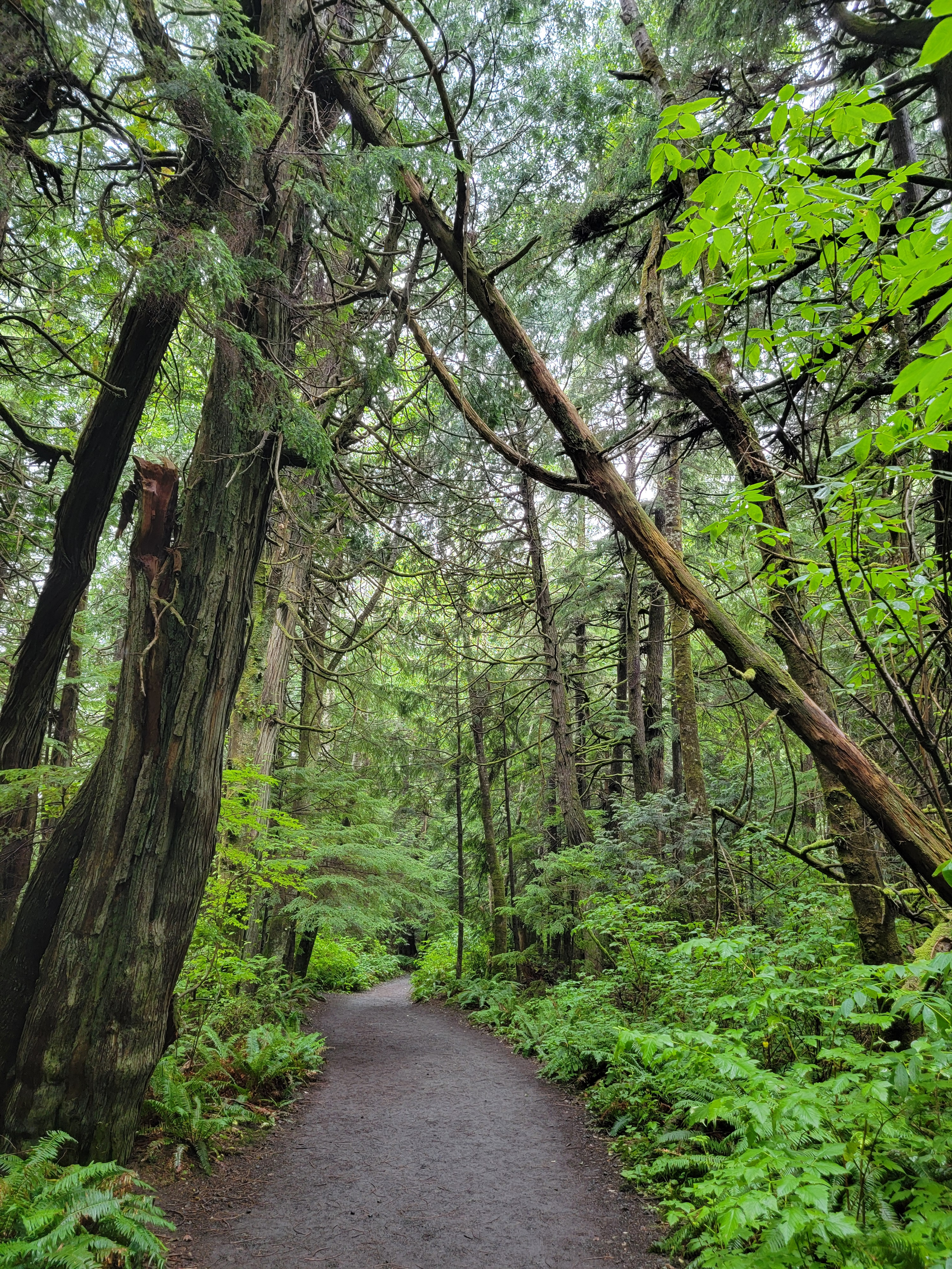 Rainforest trail on Cape Flattery
The first half of our trip was centered around Port Angeles. The weather had been cloudy, but we had enjoyed the cool temperatures and clean air. It was a pleasant contrast from the hot and smoky weather we had for the past few weeks in Boise. So far we had been on familiar ground. Now we were heading around the west side of the Olympic peninsula, which was new territory for me. The forecast predicted that we would be seein some sun as well, which would be a welcome change. But not yet. It was still cloudy as we left Port Angeles and headed west.
First we were going to Cape Flattery, the northwestern-most point in the continental US. We turned off US101 soon after leaving Port Angeles onto a narrow, winding state road. It was a pretty drive because the highway was lined with wildflowers. There was a lot of fireweed, Indian paintbrush and some other flowers that we couldn't identify. Although colorful, it was hard to get a good look as we zoomed past. The wildflowers were the main attraction as the forest was close on both sides and there were few views of either the mountains or the sea.
Although it's only about seventy five miles, it took us close to two hours to get to Neah Bay. It's the last town before the cape and it felt very small and remote. There was a small port there. Well, at least there was one commercial dock with a small freighter there. Besides that, there was a gas station/minimart, a coffee stand and a few houses. But it's the largest town on the Makah Indian Reservation. Actually, it's the only town. We had to stop at the minimart to get a use permit to do the hike at Cape Flattery. We didn't mind as the fee goes to maintaining the trail and the parking area at the trailhead. We filled up with gas, got some snacks and our permit, and were off to the cape.
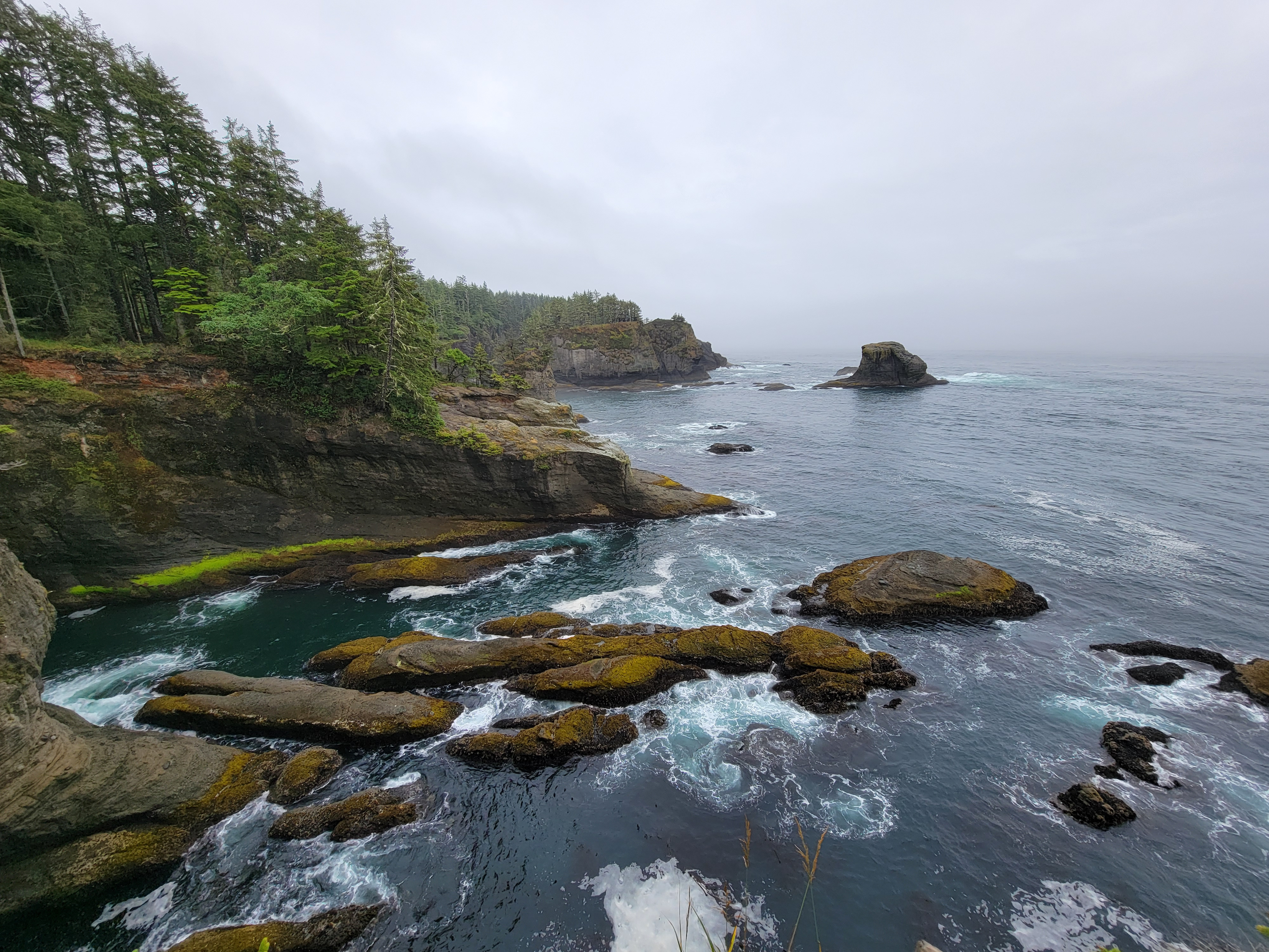 Cape Flattery coastal cliffs
It was only another seven and a half miles to the parking area. There were at least ten cars there but there were still plenty of spots left. The temperature was cool but comfortable. The sky was overcast but there was no wind. I just tied a windshell around my waste just in case the cape was windy and we started out on the trail.
From the parking area, it's less than a mile walk to the tip of the cape. The trail goes through dense rainforest and after only a few steps the cars in the parking area are no longer visible. It was a really nice trail, with a lot of boardwalk installed over muddy stretches. Near the end there were several viewpoints so that you could look out in all directions. At the very end was a large viewing platform with a view of Tatoosh Island about a quarter of a mile offshore. The side viewpoints were actually the coolest. The land on both sides rose out of the ocean in steep, hundred foot high cliffs, which the surf continuously pounded against. It would have been nice if there had been blue skies here but there was still a heavy overcast. It was still an impressive view.
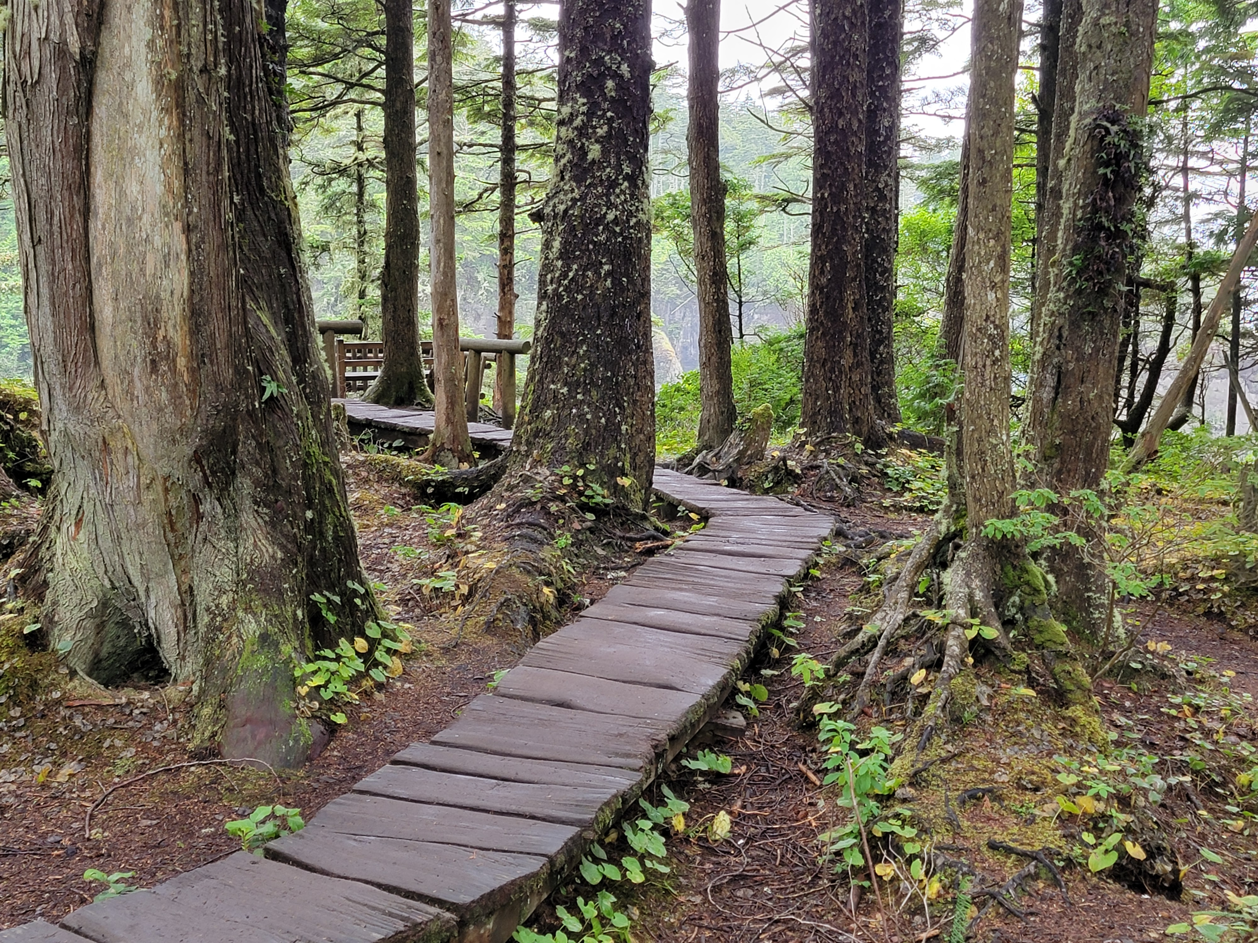 The Makah Nation did a lot of work on the Cape Flattery Trail
After the hike we drove back to Neah Bay where Sandy and Mary Beth went to the coffee stand. I never touch the stuff so I got a Diet Pepsi at the minimart. Then we backtracked to where we could cut south on a road that took us back to US 101 to continue our circuit around the peninsula. By now the clouds were begining to break up and we could finally see some blue sky.
The only town of any size that we passed through was Forks. The main street had a lot of hotels, shops, restaraunts and bars. It was definitely a tourist town. It's several miles from either the coast or the mountains but it would be a good base for accessing both. The coast west of Forks is part of Olympic National Park, with a fifty mile stretch that is the only wilderness coast left in the continental US. To the east, the Hoh and Bogachiel River valleys provide backpackers access into the core of the Olympic range.
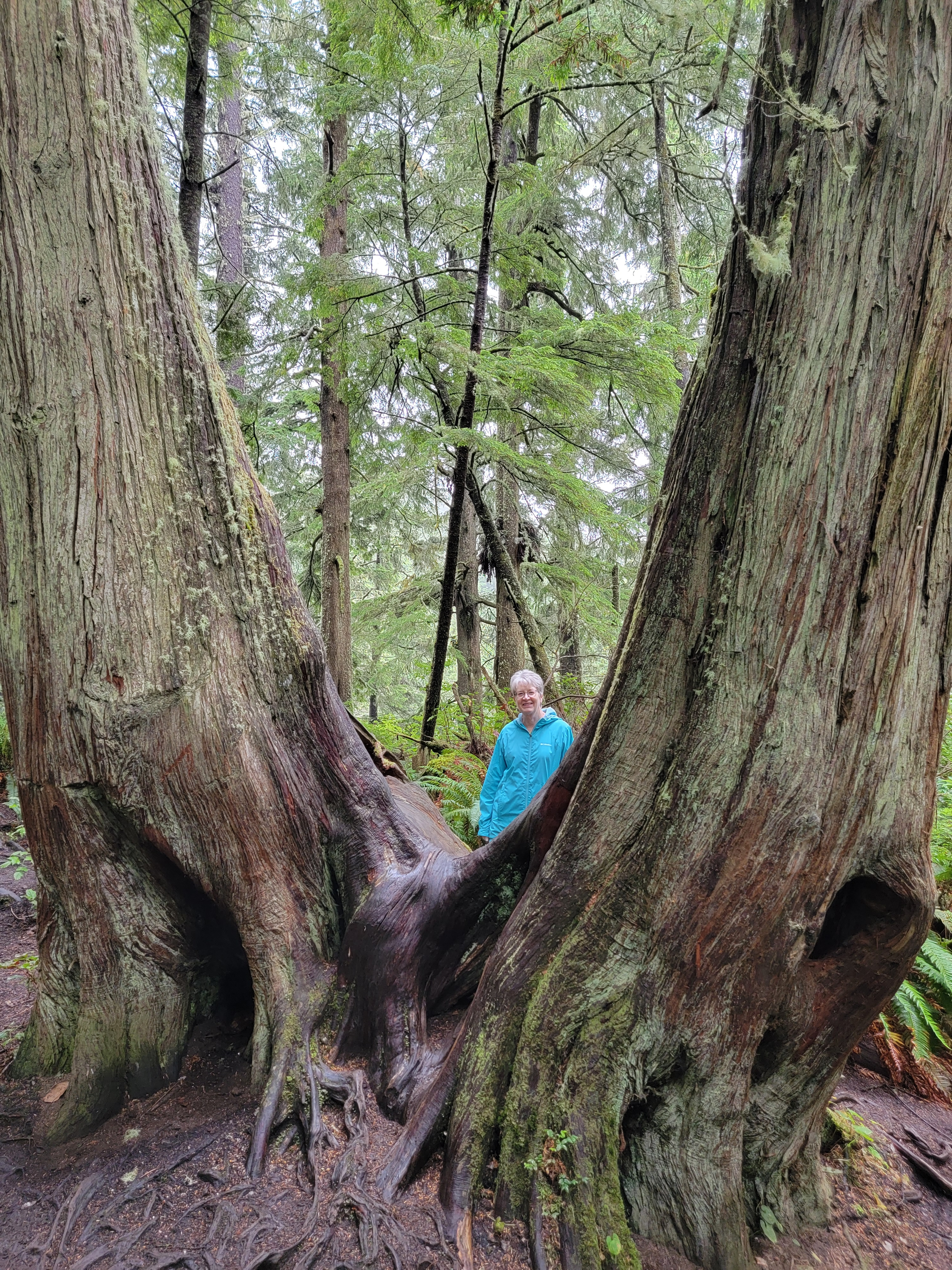 Siamese twin tree on Cape Flattery
It was already afternoon so we didn't have time to drive and then hike to any more coastal access points. We had to save that for our next trip. We did stop at the Forks Visitor Center for a restroom break. That turned out to be a mistake as there was only one restroom and there was a line. It took quite a while for all three of us to get our turn. While we were waiting we learned that the Twilight series of movies were filmed in Forks and that the story is set there. That's because Forks is the rainiest town in the continental US, which makes it an obvious place for vampires to hang out. It's where the sun don't shine, to coin a phrase. I never read the books or saw any of the movies, so MB filled me in. They had life size cardboard cutouts of the Twilight characters in the Visitor Center and people were lined up to take their pictures with them. We stuck to the line for the restroom.
Continuing south from Forks, it wasn't long before we reached the turn off for the road that goes up the Hoh River Valley. It enters Olympic National Park and ends at the Hoh Rainforest Visitor Center. There is a trail that continues up the Hoh Valley, a two day backpack to the base of Mt. Olympus. It's the approach route used by climbers hoping to summit Mt. Olympus. Our plans were less ambitious than a multiday climb. We were just goint to do one of the short hikes near the Visitor Center. As moisture laden winds off the ocean have to rise to cross the almost eight thousand foot high crest of the Olympics, they drop a LOT of rain on the western slopes. The western slopes of the Olympics are famous for its impressive rainforest. Even a short hike there would be very cool.
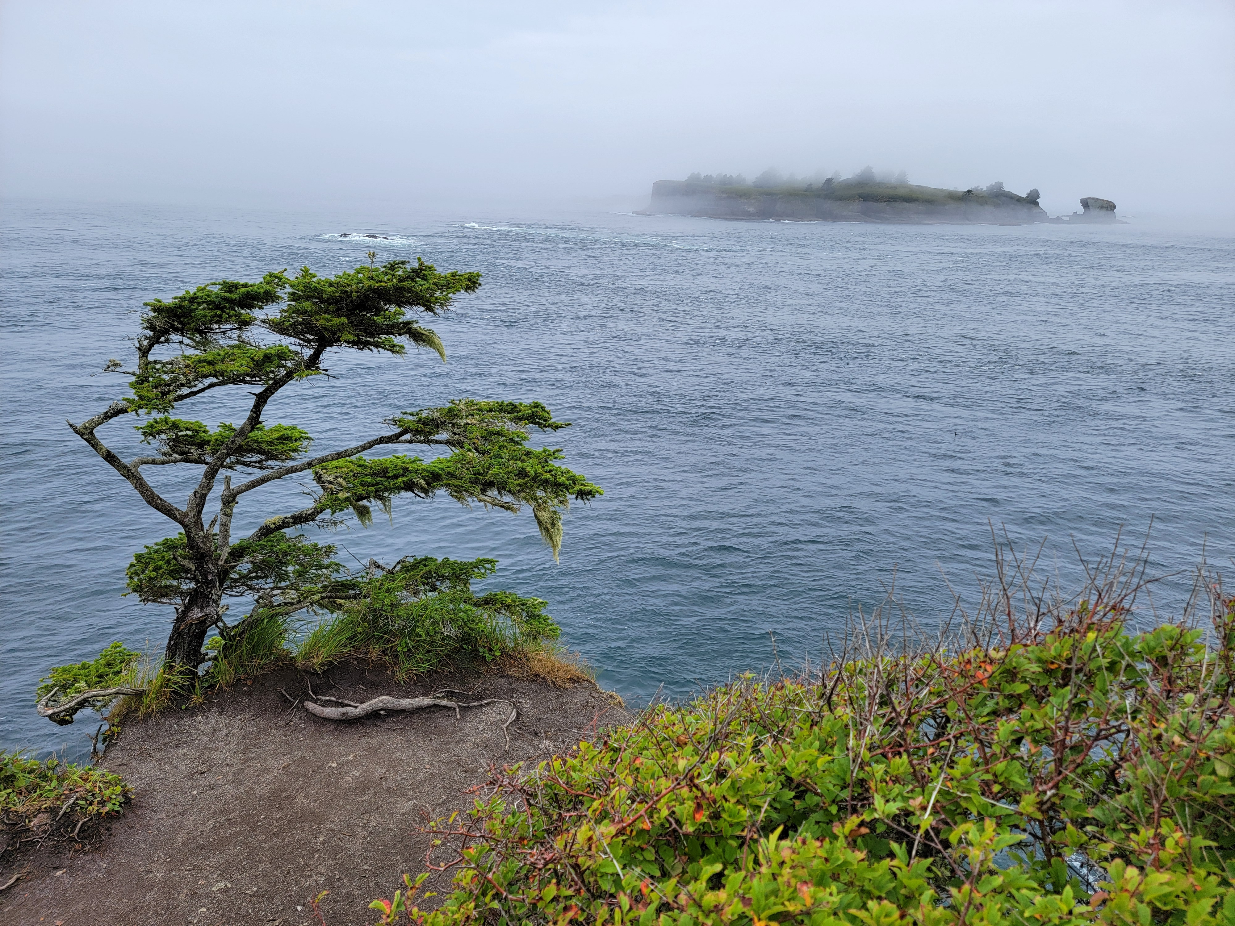 Tatoosh Island from the end of the trail
Unfortunately while still many miles from the Visitor Center, we reached the end of a long line of cars. Because parking is limited at the end of the road, the Park Service stops cars near the park entrance and only allow a car to go in when a car comes out. We couldn't see how long the line was, but we had just passed a sign that said "One and a half hour wait from this point". Just ahead of us was another one that said an hour and fifteen minutes. We waited about five minutes in line to convince ourselves that the line really did move that slowly. It did, so we turned around and headed out. The Hoh rainforest hike will have to wait until our next trip. We'll have to get up early so we can get there before the hordes. At least on the way out we stopped at a small store just outside the park boundary. I found a cool Olympic National Park tshirt that said "Hike - because people suck". It was absolutely perfect for a grouchy old hiker like me.
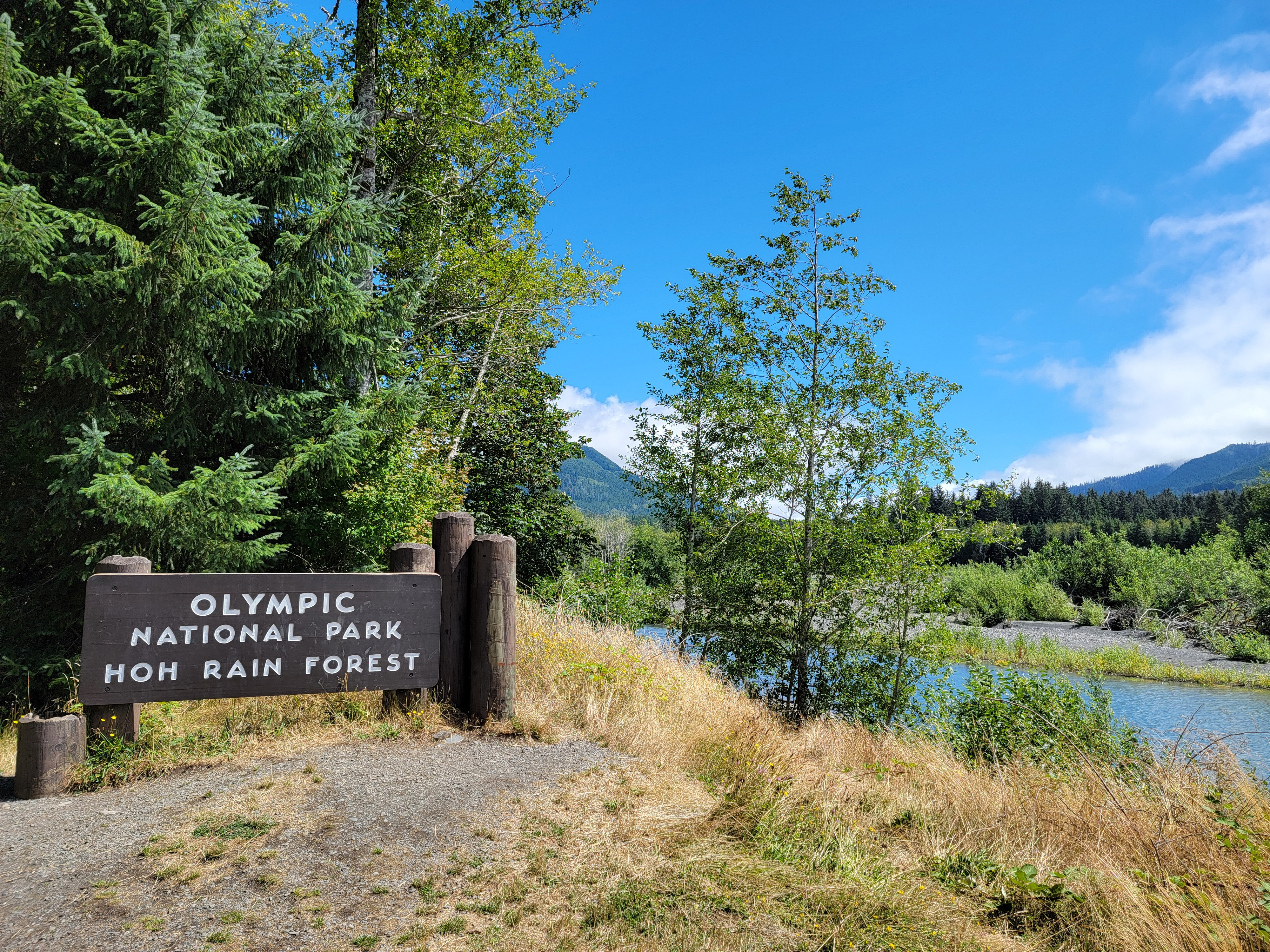 About as far as we got into the park in the Hoh Valley
We made one more stop along the way at Lake Quinault. The lake is very pretty and there is another grand old lodge right on the lakeshore. It looked like a cool place to stay and there were some good hikes nearby. Sandy put it on her list of where she wanted to stay if (when) we come back next year.
From the lodge we drove straight to Ocean Shores, where we were staying for the next two nights. Ocean Shores is on a long, low peninsula that separates the norhtern half of Grays Harbor from the ocean. About two miles from its tip, another peninsula forms a similar barrier on the south side. The entire bay is 17 miles long and 12 miles wide. At the easter end are the port towns of Aberdeen and Hoquiam.
While in Ocean Shores we stayed at the Lighthouse Suites Inn. It was a large hotel, maybe a quarter of a mile from the water. Between us and the beach were low dunes covered with vegetation. Beyond the dunes, the beach was huge. It was hundreds of feet wide and stretched along the entire peninsula for miles. Very impressive. The downside was that the road next to our hotel that provided beach access also allowed cars onto the beach. A lot of people drove their cars onto the sand and then drove up and down the beach to find a place to park. That seemed really uncool to me.
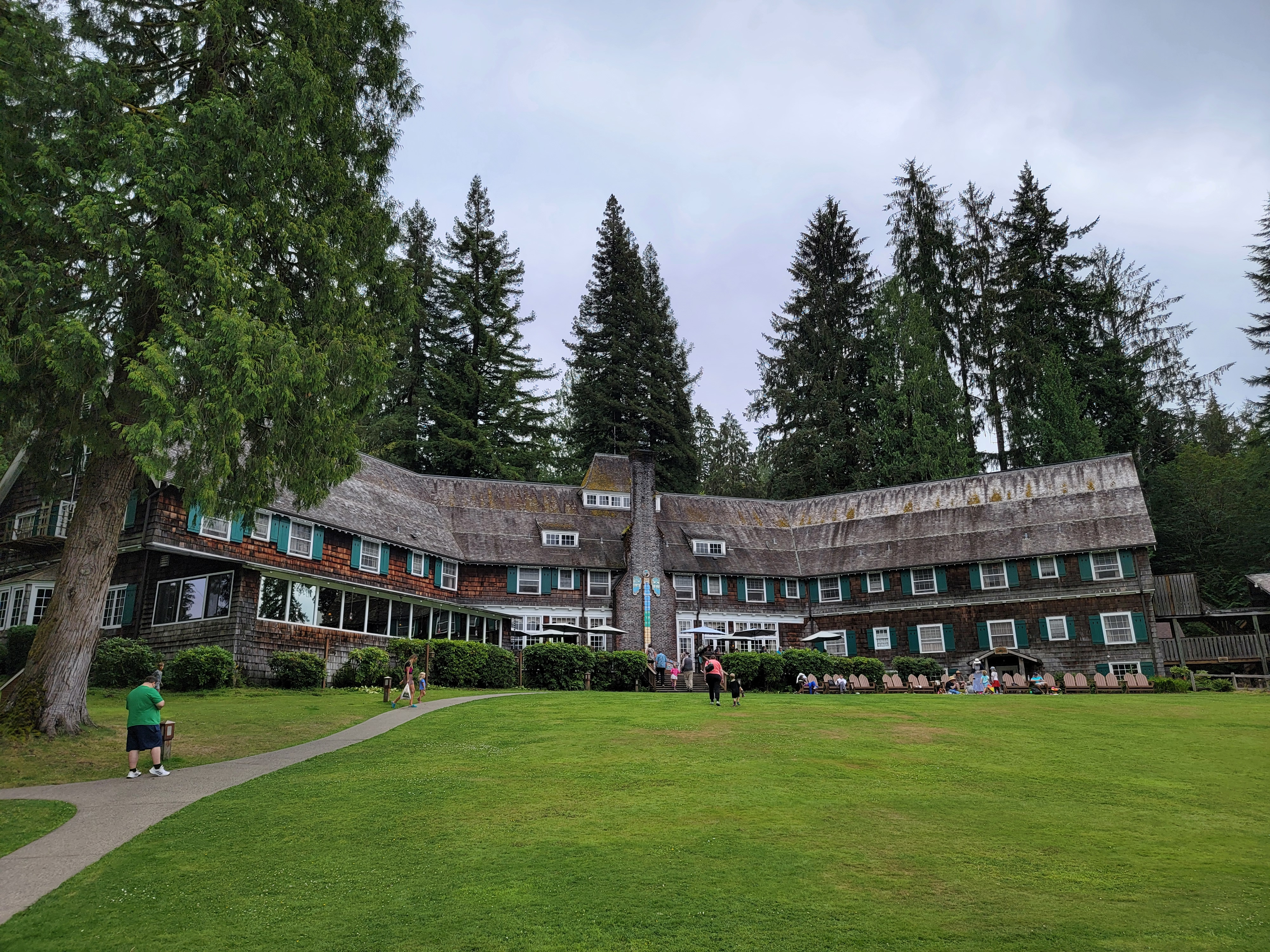 Lake Quinault Lodge
By the time we checked in and carried our stuff up to the rooms, it was late afternoon. We had just been snacking all day, so everyone was hungry and ready for linner (combination late lunch/early dinner). This close to the ocean we figured that we had to have seafood. We found Mike's Seafood of Ocean City nearby. Sandy and I decided to split an order of fish and chips. It's a dish that I really enjoy but because it is so rich I always have trouble finishing. Sandy always complains that portions are too large. Splitting it turned out to be a really good idea. The fish was excellent but we weren't too full afterwards.
Since it was only four oclock we were almost the only ones there. The guy waiting on us was quite talkative. He had a chef's jacket on and when we asked it turned out that yes, he was Mike. I bought a "Mike's Seafood" tshirt from him. I plan to wear when I see my brother Mike at our family gathering in Northern Idaho next month.
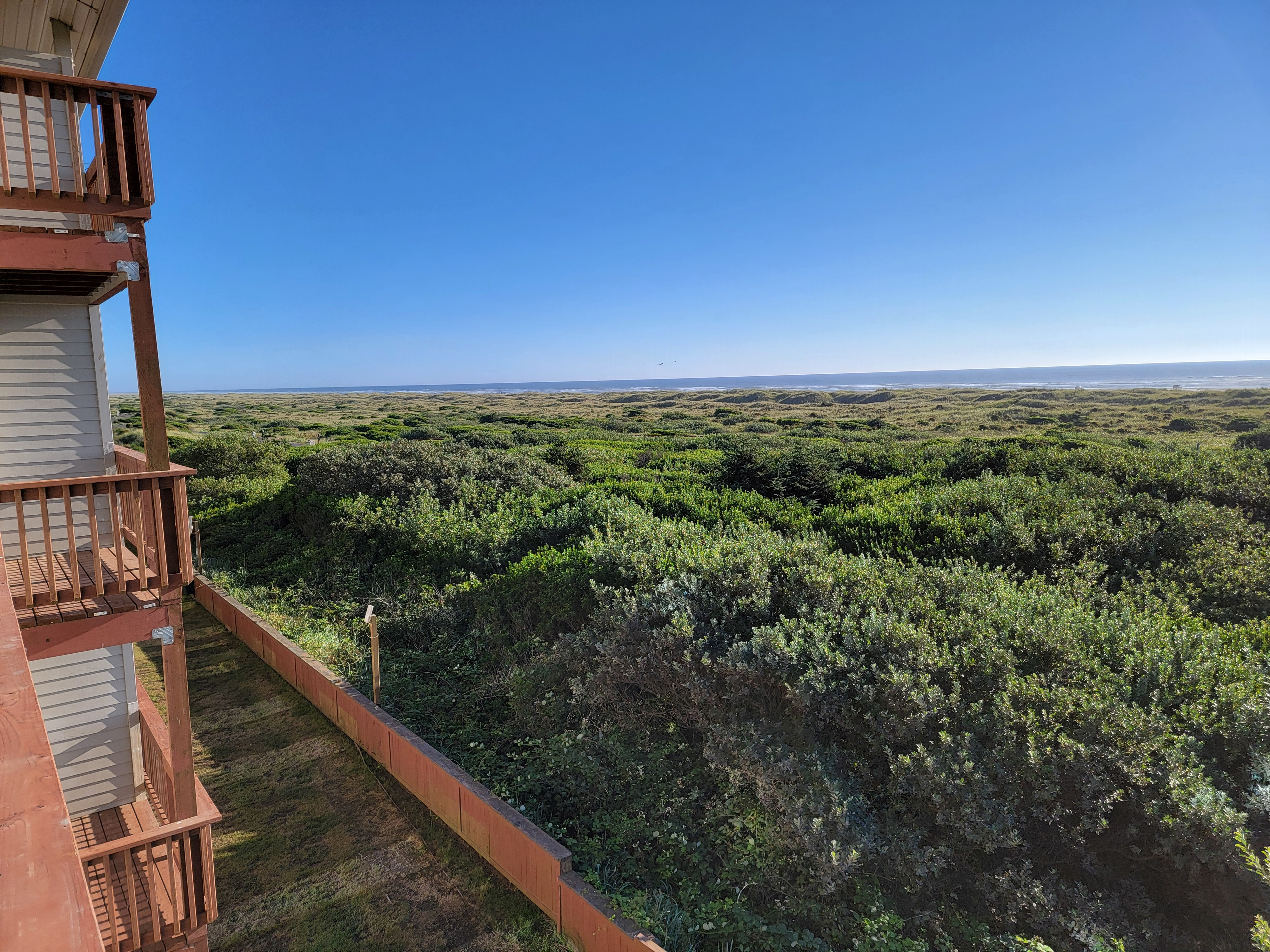 View from our balcony at the Lighthouse Inn in Ocean Shores
Back at the hotel, we hooked my laptop up to the tv in our room to watch the Brewer game. They fell behind quickly and since MB was tired, she quit at the fourth inning. Sandy didn't make it much longer. I was the only one to watch till the bitter end. They lost to the Braves 6-2 but were never really in the game. Bummer.
We had the whole next day in Ocean Shores and the forecast was for sunny skies and temperatures in the high sixties. It looked like we would have a rare perfect day on the coast. In the morning, we started by going down to the beach and taking a short walk after breakfast. I have to admit that I have never been on a beach that large, that long, that flat, anywhere. There were also weird patterns in the sand that the waves had made before the tide went down. Wavy lines, several feet wide and and several inches deep, all over the sand. I've never seen anything like that before. It looked pretty cool.
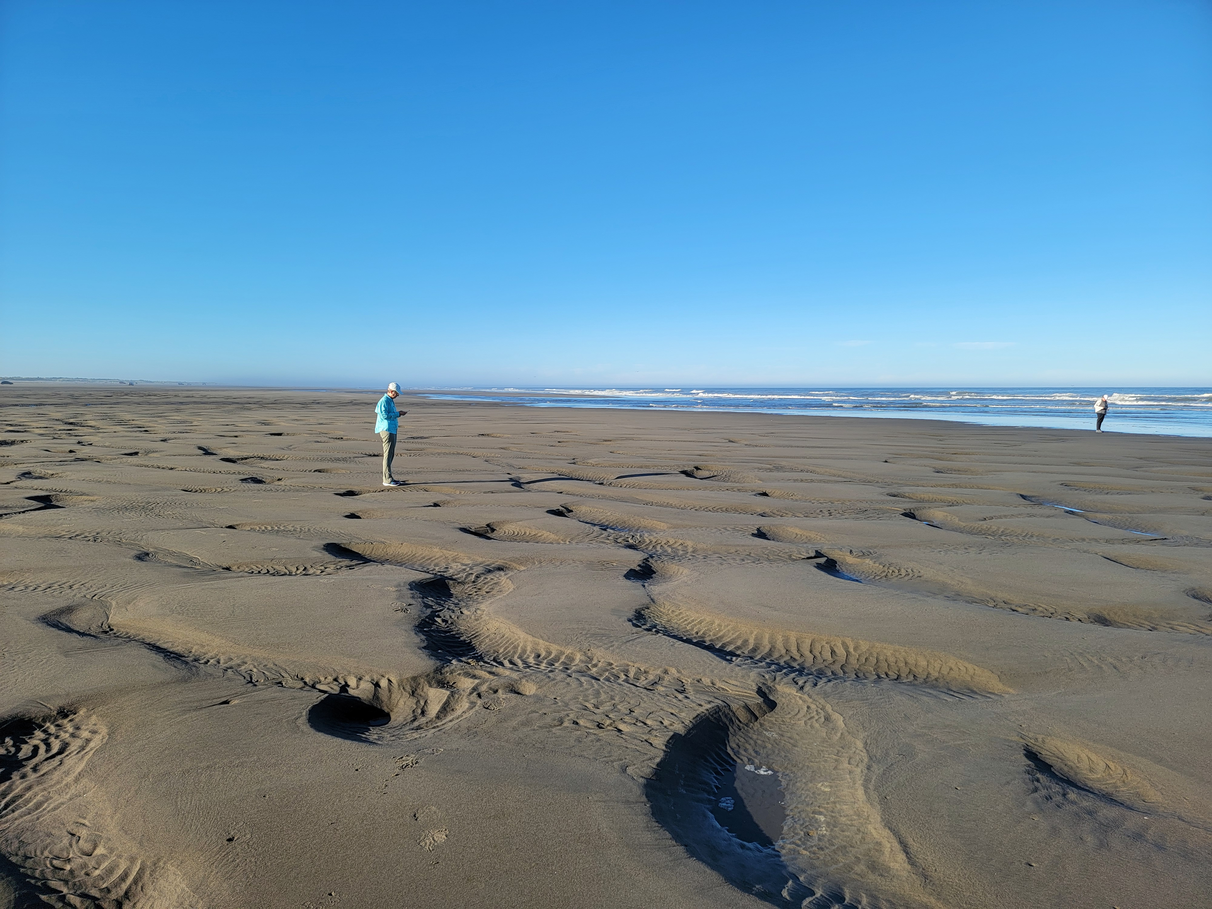 Weird drainage patterns left in the sand
When we went back to the hotel, Sandy and I climbed up into the observation tower. Since our hotel was called the Lighthouse Suites, there was a faux lighthouse structure on top of a fairly ordinary four storey hotel building. The evening before I had found the access stairs to the tower. They had been doing work on it - the stairs and the observation deck had a lot of tools and several ladders and various cans of paint scattered all over. But we were able to climb over and around everything to get up there. It was worth it. The view was impressive.
When we left the hotel the first thing we did was drive to Point Brown, the southernmost end of the peninsula that Ocean Shores is on. We parked and walked out to the beach, which ended abrubtly at a rocky jetty that lined the entrance to Grays Harbor. Two miles away we could see Point Chehalis, the end of the peninsula that formed the southern enclosure of the bay. From here we could see how big the bay was, and it was huge.
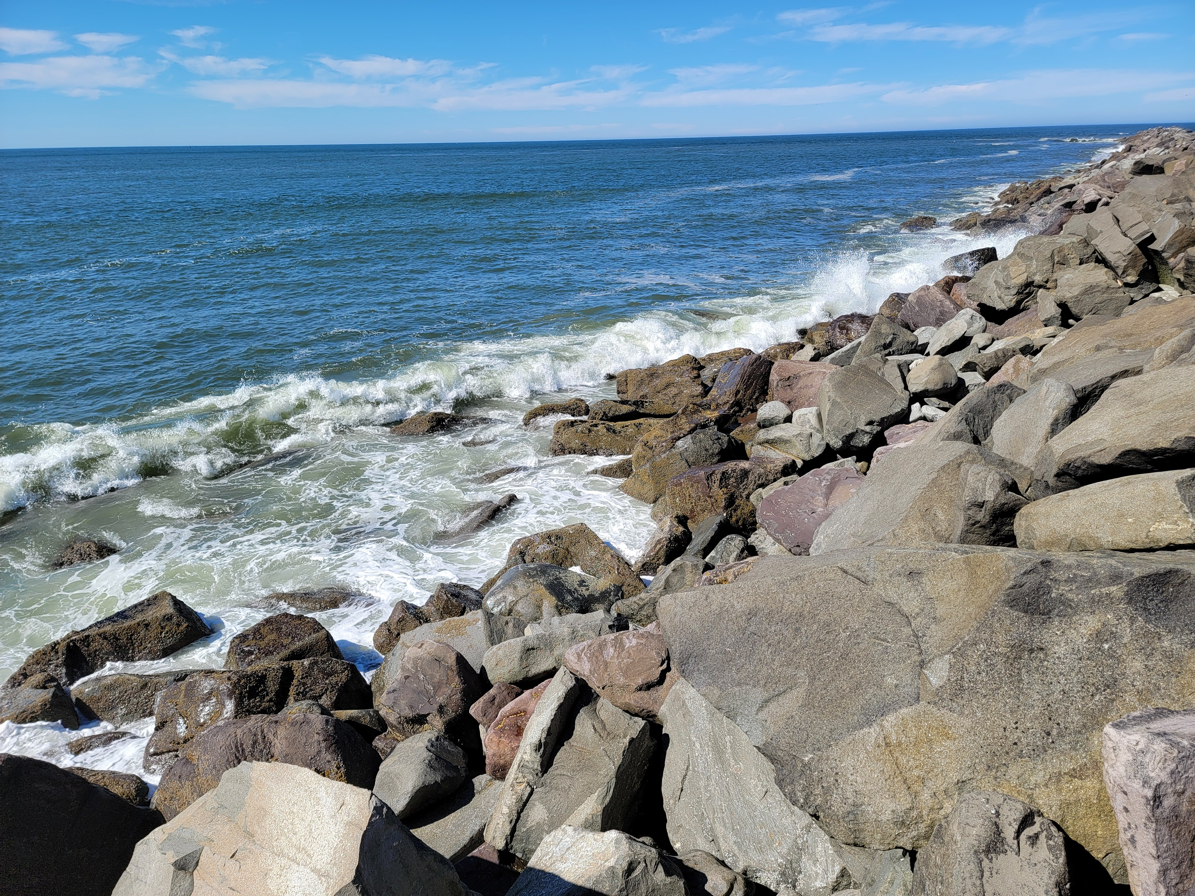 Surf breaking against North Jetty at Point Brown
Our next stop was at Damon Point State Park. I had read that the park was a low piece of land that jutted out into the bay, and that it was possible to walk around it along the beach. That sounded like a good hike. But checking Google Maps, it showed it not as a small peninsula, but as an island not connected to Ocean Shores. We really didn't want to wade or swim out to do a hike. The only way to find out if it was doable or not was to go there and try it. It turned out that yes, it did connect. And it was a fantastic beach walk.
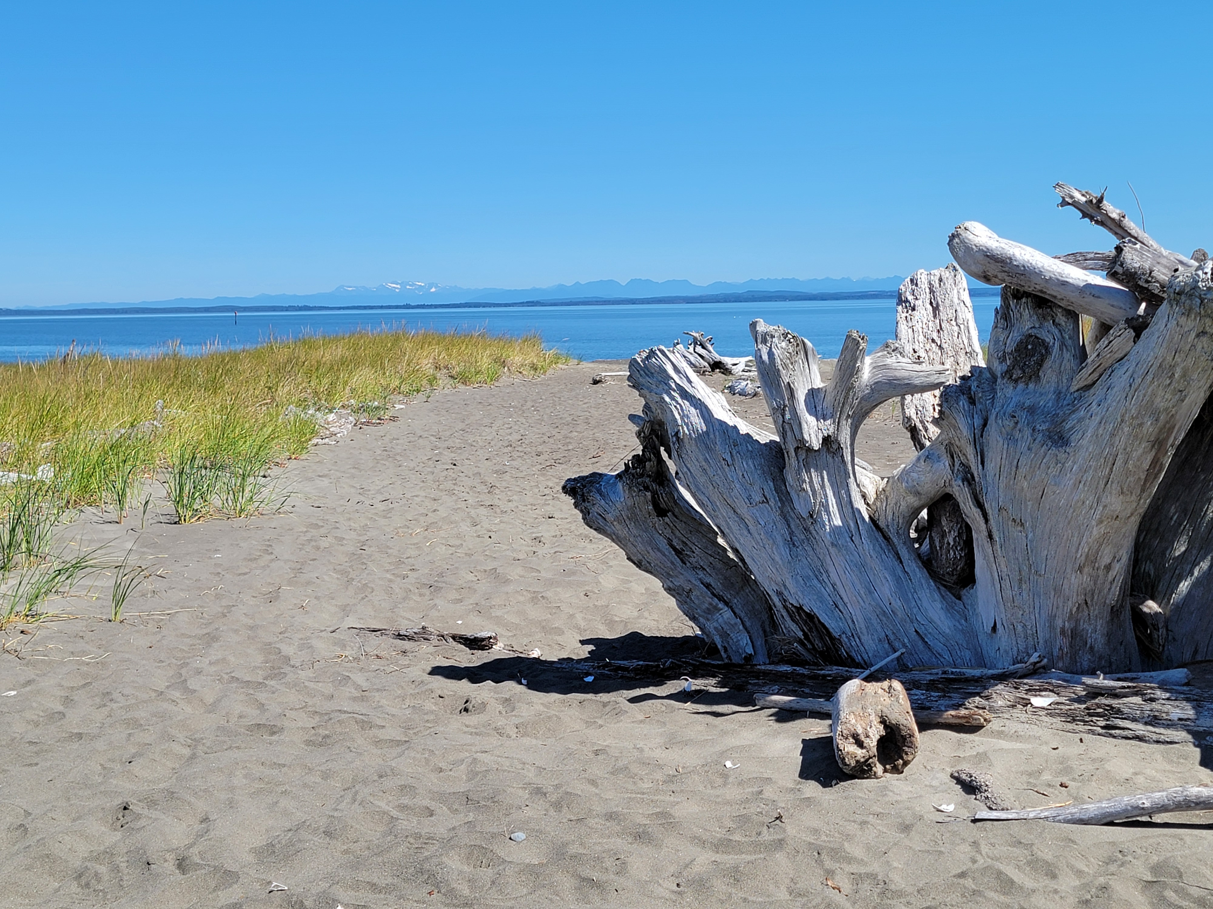
It was a bright, sunny day with blue skies, and not a cloud visible anywhere. The temperature was perfect for walking. There was even a slight breeze so we didn't get sweaty. All around us were the waters of Grays Harbor. Across the bay we could see the towns of Hoquiam and Aberdeen, with forested hills all around them. Rising in the distance were Mt. Rainier to the east, and Mt. Olympus to the northeast. There were a lot of shells that washed up on the beach and Sandy collected a whole bag of them to take home with us. The sand was firm which made for easy walking, except for climbing up and down one or two steps getting on and off the beach. Sandy and I didn't have any problem but MB did go around to avoid them on the way back to the car.
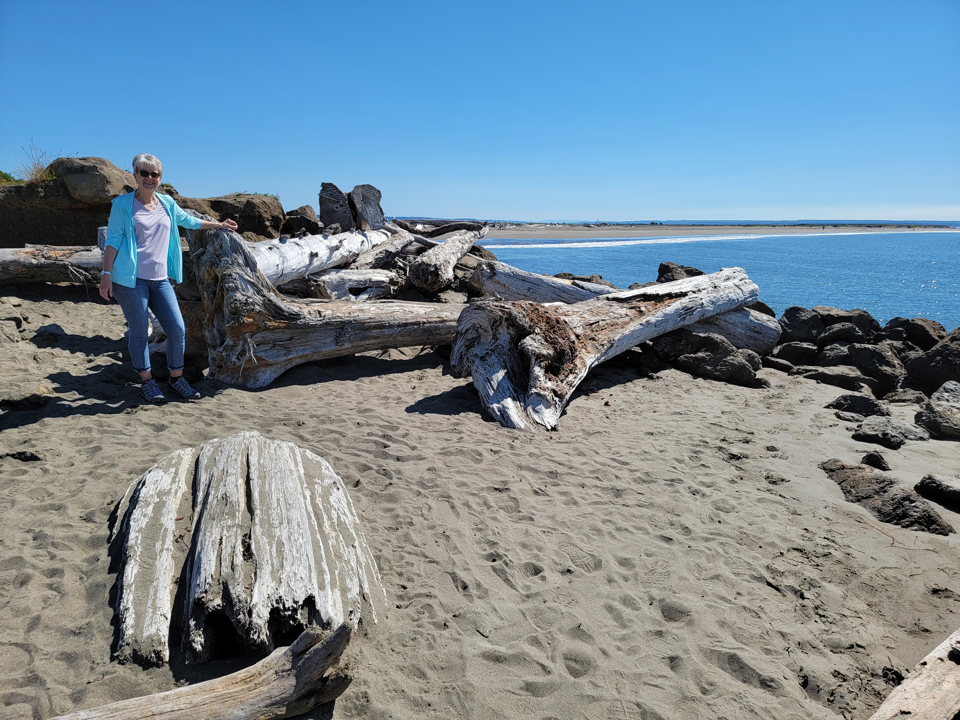 Serious driftwood on the beach at Point Damon
By now it was time for a snack and something to drink. Our first stop was at Beach Treasure Coffee and Gifts. Their website showed lots of pictures of bakery goods, cold drinks and, of course, coffee, which is what Sandy and Mary Beth were after. But when we went inside the place had been gutted. It was practically empty and only the coffee bar was left.
That didn't work for us so we moved on. Next we tried Ocean Beach Roasters. We had better luck there and I scored a cinnamon roll and a Diet Coke. Since I had skipped breakfast it really hit the spot. I did think that this place was a little odd though. The entire inside was covered with every possible variation of gay pride flags. It's one thing to be an ally and another to consider it an interior design motif. I was just there because I wanted to get a cold drink and a doughnut, not because I wanted to change the world. Let's not get carried away.
 Olympic Mountains in the distance from Point Damon
Fortified with food and drink we decided that we were ready to do some serious shopping. To start off, I took one for the team. I had seen a soap shop on the map that I knew the ladies would like, especially Sandy. Sure enough, we ended up spending quite a bit of time there.
Then it was my turn. We went to Sharky's, a gift shop with a lot of stuff, but realistically it was primarily tshirts. It was definitely my kind of place. It was easy to find as the entrance was through a gigantic shark mouth. When we got there, it turned out there were four different tshirt shops at that intersection. I was in heaven. Of course I had to check out all of them. I am a completist, after all. Of course I found some tshirts to buy, as well as a Hawaiian aloha shirt with a shark design. I plan to take it on our family dive trip to Bonaire in December to wear in the evening. It should get noticed.
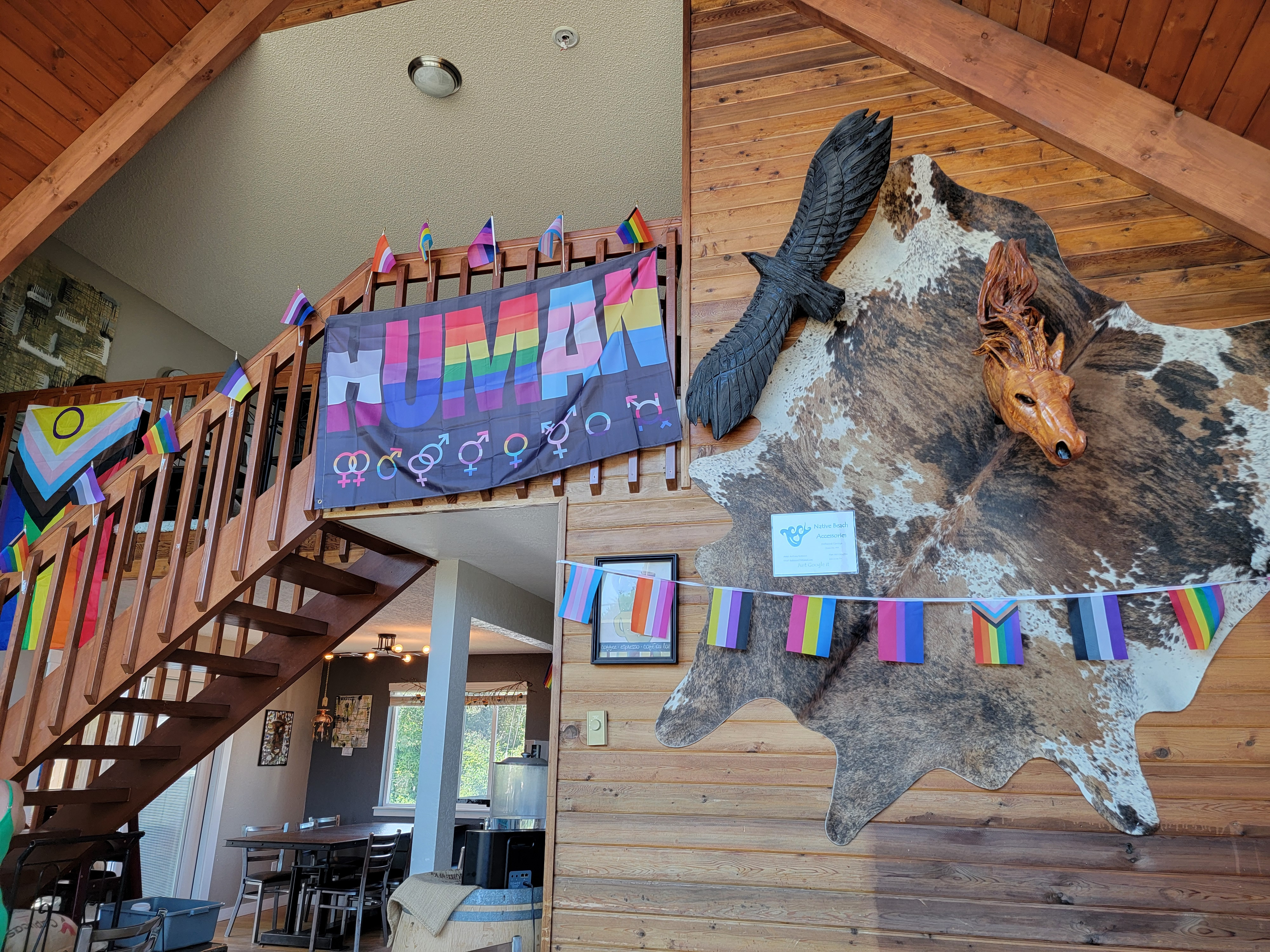 Inside Ocean Beach Roasters
We did one more short walk in the afternoon at Weatherwax Nature Preserve. It's a small piece of rainforest preserved right in the middle of the town of Ocean Shores. And again, since the forest was so dense, a minute after we started out we were completely surrounded by the trees and couldn't see the city around us. The trail passed several lakes but we could hardly see them through the trees either. It was less than an hour but it was a nice walk.
When we finished our hike it was time for an early dinner. We wanted to try eating at La Spiaggia. It was an Italian restaraunt featured on Americ's Best Restaraunts and it didn't disappoint. We had bruschetta to start and it was amazing. For the main course I had gnocci, which was excellent. The wine was very good as well. The only drawback was that the food had so much garlic that I swear I was still tasting it three days later. Still, it was worth it for an incredible dinner.
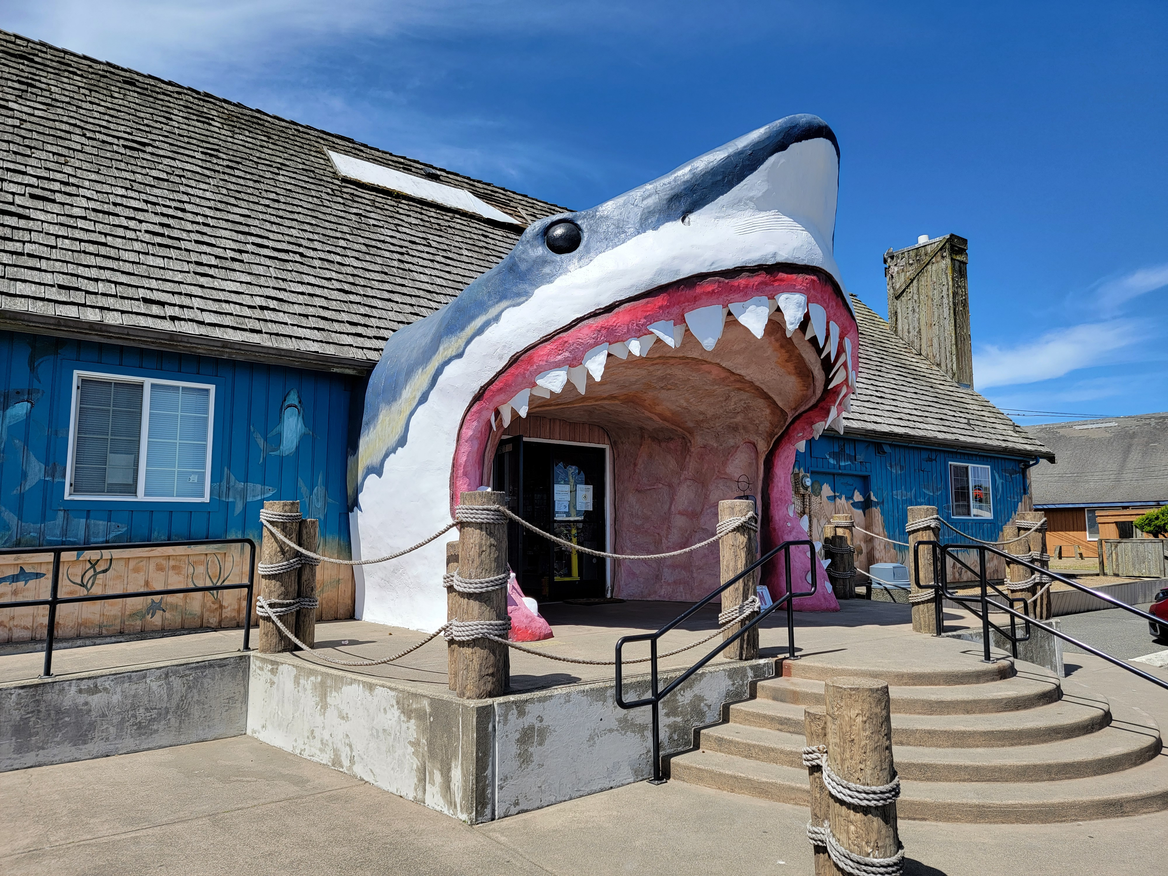 It's hard to miss Sharkey's Gift Shop
The next day it was time to head back. We only went as far as Prosser, where we stayed for the night. We got there early enough that we could go to some of our favorite wineries to taste and stock up on wine to take home. We started at Witt, then moved on to Thurston-Wolfe, my personal favorite. We had dinner at Whitstran Steak and Spirits and then watched our last Brewer game of the trip. It was a happy ending as they beat the Nats 8-3.
Next day we had an easy drive home. It was especially easy for me, as Sandy drove all the way. I had done virtually all the driving on the trip so I was kind of burned out on driving by now. I just relaxed (ate snacks, napped, etc.) in the back seat all the way home.
Considering that we had to change everything only a few days before leaving. it was an excellent trip. I know Sandy liked it because she is already proposing where we will stay when wo drive around the Olympic Peninsula next year. It is a good way to beat the heat and avoid the smoke from forest fires. A good way to adapt to taking vacations in the 2020's.
